PlanTest is a new type of software for a new way of doing business. GPS has made everything faster, better and digital for survey. Faster, better and digital is achievable for cadastre too. PlanTest creates the processing control that attains unprecedented levels of rigour, productivity and speed. With custom data portals, your workflows and integrated databases, PlanTest enables fully digital solutions for cadastre.

A fully digital system is a current goal for many cadastres. These new systems require new approaches to work and processing. The PlanTest vision has a concept we call digital cadastral transactions: similar to banking transactions, but more complex and often extended over long periods of time. This transaction concept is central to PlanTest design. We believe that automated quality control, like PlanTest provides, is absolutely necessary for secure and reliable digital cadastre.
PlanTest is at heart a decision support tool. Do you accept or reject a submission? How do you apply laws, regulations and established policies to make this decision? In what way do you substantiate the decision? PlanTest has a complete set of customisable components that help you address these points.

The solution architecture of PlanTest is based on a simple high level workflow: analyse, review, decide. The controls, tools, reports and maps all fit into this general concept. PlanTests then supports any number of specific workflows, each associated with a submission or plan type. These workflows are completely customisable by you, without programming.
PlanTest has different configurations and platforms to be used throughout the cadastral system. It can be used with advanced databases, with files, or both. It may be used as a primary workflow, or as a subordinate 'black box' in an existing workflow. For a particular jurisdiction it may be heavily analytical and automated, and for another jurisdiction easily set up to assist lands officers who make all decisions. It has been designed from the beginning to be very adaptive. For advanced and developed cadastres it can extend existing digital systems with minimal impact on IT resources. For developing cadastres it can be an easily maintained option where IT support is strained or unavailable.
Cadastral offices typically process transactions or changes against the established records. That is, someone wants to subdivide or combine parcels of land, or alter the status of ownership or encumbrances. Whatever the motive, a change is submitted to the cadastre for consideration and the cadastral officers evaluate the transaction materials to validate the quality and appropriateness of the submission. If everything is in order, the transaction is recorded against the record (digital databases, fabric or files), the parties are given certified documentation of the change, and the current state of the jurisdictional cadastre is updated to reflect this change.

If the submission is flawed in some way, the officers respond to the submitting party for correction of errors and omissions. It is this workflow that PlanTest aides and improves with increased rigour and improved performance, recording and responsiveness..
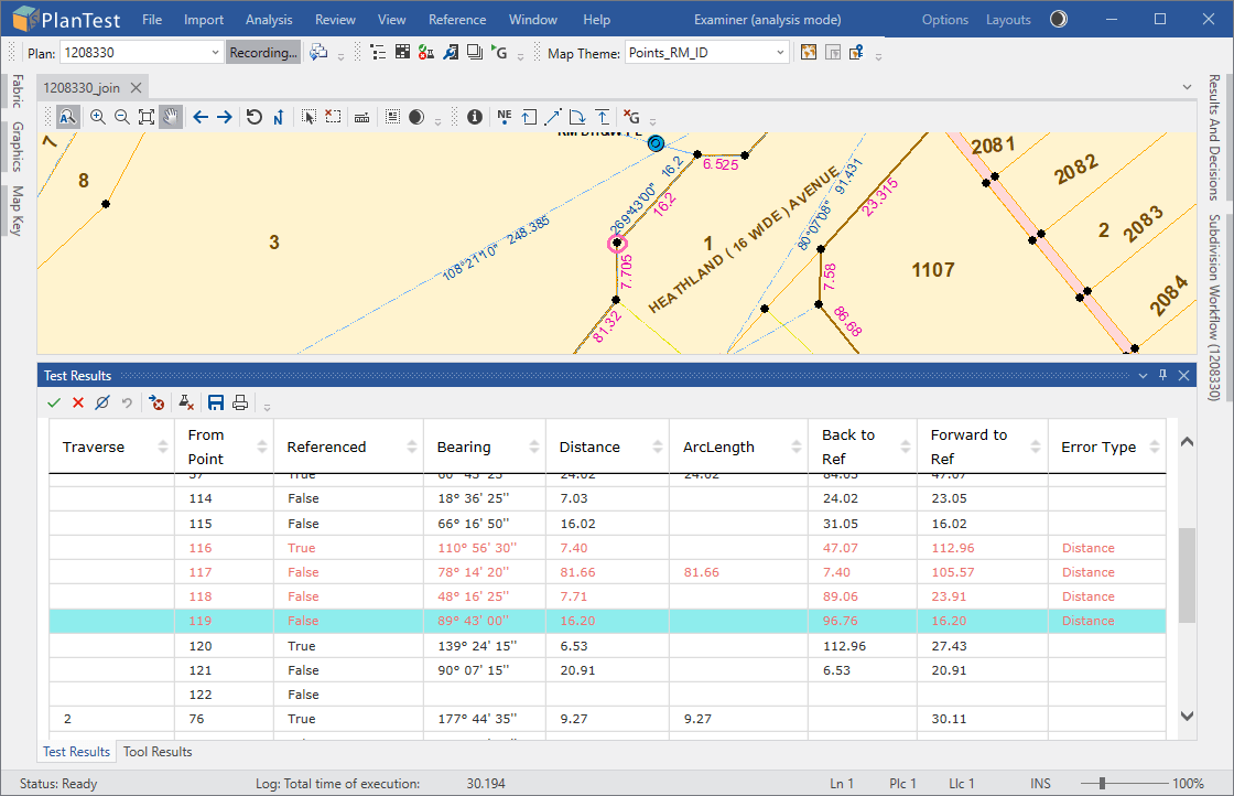
Many digital cadastres now have or are planning web portals for submission of cadastral transactions. PlanTest server technology can be integrated into such portals for automated testing. PlanTest Examiner is a tool for cadastral officers who are focused on more in depth and flexible investigation and examination. For the cadastral officer, PlanTest Examiner quickly handles the routine submissions, and helps them do a better job reviewing difficult cases.
PlanTest is customised for the jurisdiction and site to include the needed processes and analytic tests. Determinations of acceptability or rejection may be automatic or solely at the action of a cadastral officer. The basic idea is that digital submission is made to a receiving portal or digital agent and then it is internally validated according to established rules. The submission is then accepted, and land status altered, or it is rejected with explanation of necessary remedies.
PlanTest is an application composed of controls, tools, reports and maps. Of course, there are many other underlying components that make it all work. However, PlanTest design is to simplify the working environment to increase productivity. So we present only the parts you need, just when you need them.
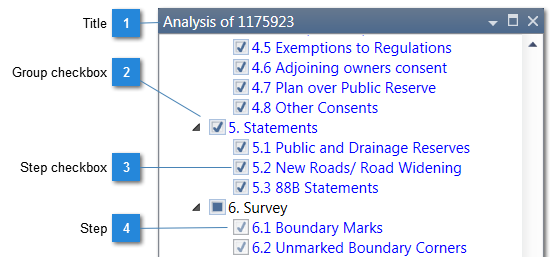
Analysis can be run as an automated set of tests, or run one by one manually. The Analysis Control allows user driven decisions and analysis directly against a workflow tree specifically created for a particular dataset. Steps can have associated analytic tests, or be visual checks.
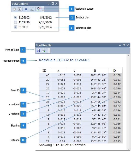
Tools allow investigation of complicated survey data and also have corresponding presentation tables, also linked to the survey features in the maps.
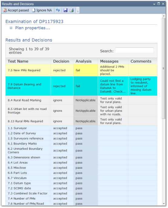
Results of analysis tests are presented in pages that have message lists and tabulated records linked to mapped survey or spatial features. Batch results, summary reports and examination reviews each have a special presentation page with its own controls.
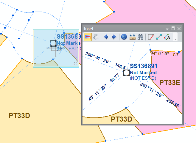
Maps, which contain survey data and associated GIS or raster image layers. The main map is associated with the survey data being evaluated. An inset map allows you to have a close-up view of the features of interest. You can add additional reference maps.
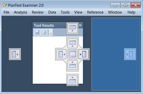
Support for the PlanTest integrated environment requires a fully featured Multiple Document Interface (MDI), which is new to this version of PlanTest. Floating and dockable windows, tabbed window groups, hidden windows, pinned windows and docking guides are all available. So you can create nearly any layout you like. Furthermore, each user can save the layout they have created that suits their working preferences.
A complete Multiple Document Interface framework for Dockable Windows is the core of the PlanTest User Interface. This is necessary because cadastre often requires numerous data sources and reports for reference during an investigation. In PlanTest, you create the layout for core components and ad hoc windows that suits your working style.
The following is a typical workflow for the examination of a submission. If the plan is a simple subdivision, then the job will be completed very quickly. Of course, some submissions are complex and require considerable review and inspection.
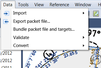
PlanTest is usually customised to load a jurisdictional data transfer file, or it will be automatically created by a PlanTest plugin to a web portal. Starting the examination just takes a click. A workflow associated with the plan type is retrieved.
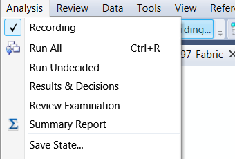
Next, you probably want to run all of the steps in the workflow that are fully automated; it takes just a few seconds. This can be set to run automatically when a new submission is loaded.

Now you check the test results, and make choices to accept the plan as having passed or failed each step. There are quick ways to do this, and it doesn't take long. If the problem is unclear, you need to investigate. To help you, there are maps and tables of the data and results as well as special tools to inspect cadastral data quickly. Rapid comprehension of issues is a key part of PlanTest design. PlanTest has 'just in time' menus and toolbars to give you what you need at just the right time.
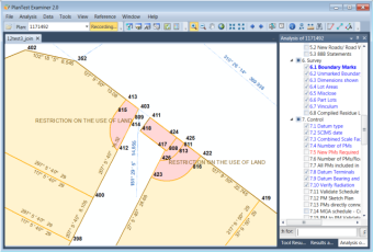
Not all steps in an examination need to be automated. You use the Analysis Control and the steps workflow for visual workflow steps. Steps not fully analytical may still be associated with specific map and report views. You can also run individual automated tests again.
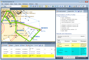
When the workflow is completed, you will make the overall decision, or even that may be an automated step. Part of the automation can be a push rejected plans into a messaging system that will convey the results and comments to the interested parties. If the plan passes, then the results of the examination may be archived, and the final steps of the transaction handed over to a manual or automated title system, while the survey data can be inserted into a digital cadastre database.