Features
- Decision Support
- Automated analysis
- Custom Workflows
- Cadastral Tools
- Smart Maps
- Dockable Windows
- Dynamic Test Results
- Stand-Alone Workstation
- Enterprise Workstation
- GIS Integration
- Customisable

This is the Ultimate Tool for Cadastral Officers.
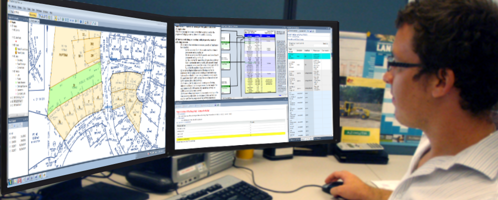
Desktop Pro is a complete solution for the cadastral officer. PlanTest analysis is embedded in a flexible docking windows workstation application that incorporates every aspect of plan examination. It excels in rapid automatic examination and review, but its real strength is in the deeper inspection required for unusual circumstances. Professional judgement is required sometimes, and when it is, PlanTest Desktop Pro ensures you have all the information and advanced tools you need to make a determination. Most officers use a multi-screen hardware setup, to get the most from the software.

Smart Maps and the Power of ESRI's ArcGIS.
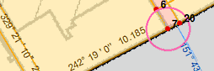
You have the worlds leading mapping technology for advanced maps because we embedded ESRI's ArcEngine in PlanTest Desktop Pro. It gives you great mapping, but also allows for a full integration with any GIS data in other systems. We extended the ESRI map control to create our smart map technology, which syncronizes the map display to the current workflow step. The map view is based on the parameters you stipulate in your workflows. We also create inset map controls that are linked to the results tables to automatically zoom to features of interest on the map.
PlanTest Desktop Pro requires an ESRI ArcEngine license. The embedded ArcMap control provides both an advanced mapping component and the ability to fully integrate with your GIS.

Desktop Pro is an advanced version of PlanTest designed for intensive use, all day - every day.
PlanTest Desktop Pro can perform all the computations of the server as well as all supply interactive investigation tools. It is fully configurable, and is a flexible, true multiple monitor MDI UI, that can be adapted to provide the most efficient environment for your work.
It is the best cadastral workstation, without comparison. It can be used stand-alone, as part of a work group with shared configurations and data, or as the top seat in an enterprise systems. The dual-monitor evolution arrived. A rapid decline in the price of LCD monitors, coupled with the proliferation of well-priced graphics cards with dual-monitor support, allowed you to equip your most-valued staff with a second monitor. The result: Dramatic increases in productivity. Better still, many using dual-monitors say they actually enjoy their work more. Freed from the frustrating task of tiling through windows, they find themselves spending more time actually getting things done.
Stand-alone or part of your enterprise system, it can dynamically change as needed.
Desktop Pro can be used as a single stand alone workstation, with no network connection dependencies. It can be used in work groups that share customisation and data in folders and databases on an intranet. And it can be the advanced workstation for an enterprise, where it integrates with existing databases and services. Of course Desktop Pro is designed to work seamlessly with PlanTest Server, which itself can be integrated with your web portals and job control systems. It can be easily switched from one configuration to the other.
The key to this ability is the way PlanTest products are configured through easy to manage XML files. You can even use these configuration files to create different work groups that share customisations and common work areas that are suited to specific purposes. For example, a data editing group might use PlanTest to check manually entered or digitally converted data as part of a data conversion project. This data quality control would use different tests and workflows than a work group that performs plan examination and registration.
Your Schema and Databases.
PlanTest must be adapted to your data schema, so we can adapt tests to your data attributes, and read and write your preferred file and database streams. We have an internal generic cadastral model that is adapted and extended to represent your model. This approach allows diverse data representations without changes to core PlanTest modules. We provide this customisation as a service, and it is generally the main task to adapt PlanTest to your jurisdiction and site.
Schema adaption includes fitting the model at the high level of basic features (such as parcels, lines, and points) to added feature properties, enumerations and relationships. You do not need to change to the Seaconis Model in your database or files. Part of our work is to build specific transfer functions (using our ETL modules) which will support your existing stores. Best of all, the schema customisation is reused for all PlanTest products - as it is plug-in to the core PlanTest modules.
Your Workflows.
Your business processes are what matter, and you just put them in and go. Workflows are the main driver for both automated analysis and interactive examination. Think of them as an automated check list. You can create and manage your own workflows without the use of programming. Workflows may be shared across an organization or limited to specific work groups or individuals.
You can begin with a series of steps that represent your processes and actions. Each of these can be tied to map views that you can also create without programming, as well as other workflow meta-data such as the step name, description, tool tip text, messages and so forth. Each workflow can be tied to a particular transaction type. You can then start using PlanTest for production work.
Of course, the idea is to provide more automation of analysis and tests. Seaconis will create tests specific to your jurisdiction requirements and preferences. We have a large existing test code base. For some tests, only minor changes will be required to make them work for you. Once automated tests are added to your workflow, the powerful Run-All command will execute all tests in the current workflow in a single operation.
Your Preferences.
PlanTest lets you set and save personal preferences for the working environment. You can create the windows layout you like best, using docking windows, nested windows - in all sorts of arrangements. In addition, your site can customise the presentation of reports and tables using standard web CSS, XSTL and HTML. You create your own map views using the industry standard mapping software, ArcGIS.
The look and feel of PlanTest can be your own. PlanTest is not a big, complex, one-size-fits-all application that is difficult to learn and use. It is designed to be highly focused and efficient, and therefore a pleasure to use. You spend you time thinking about the true nature of your work, not trying to figure out how to use the software.
